
DNR
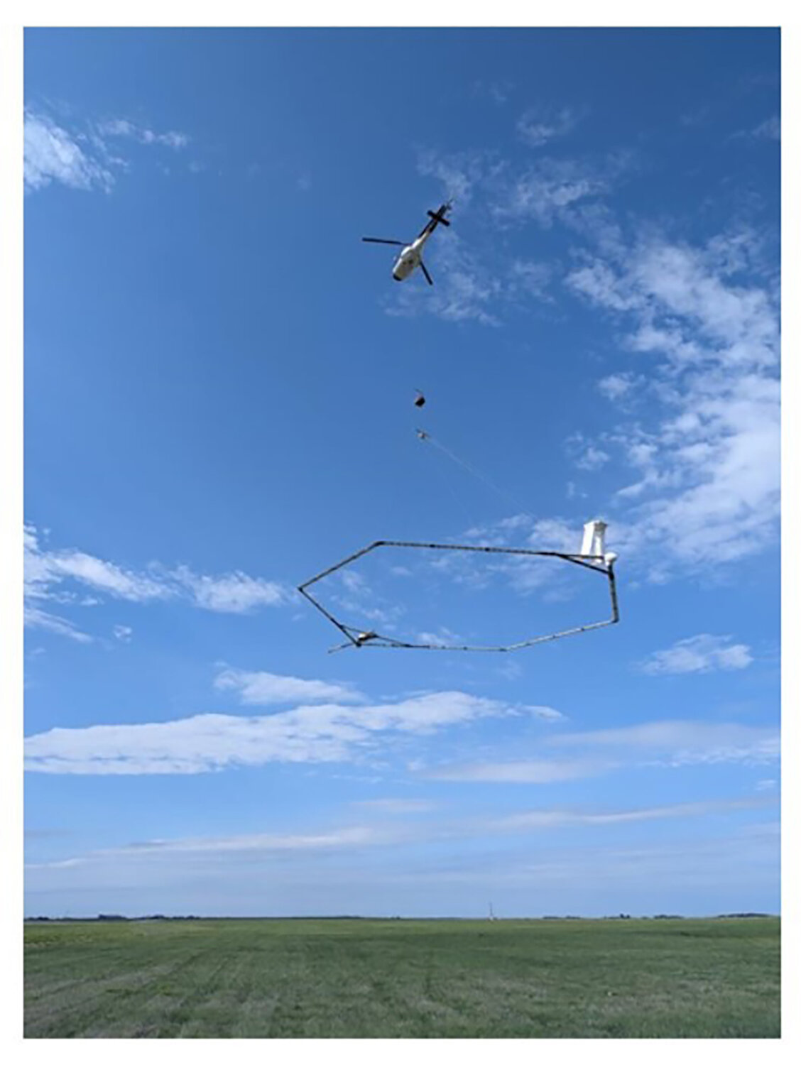
JEFFERSON CITY — The Missouri Department of Natural Resources’ Missouri Geological Survey is continuing its northeast Missouri aquifer study this summer and is extending the project into Adair, Knox and Lewis counties. From 10:30 a.m. to 11:30 a.m. Monday, June 29, MGS will join with project partners SkyTEM Canada and Aqua Geo Frameworks to host an open house at the Kirksville Regional Airport to share more information about the study and invite the public to see the helicopter that will be the conducting low-flying airborne electromagnetic surveys in all three counties.
“As part of this project, we have already collected valuable data by conducting airborne electromagnetic surveys in Clark, Scotland and Schuyler counties,” said Kim Huckaba, MGS’s groundwater monitoring unit chief. “This study’s goal is to find sources of potable groundwater to assist landowners in locating favorable water well construction sites, which may provide solutions to negative drought impacts on the region’s water supply.”
From now through the end of July, residents may see the helicopter flying low while towing a large hexagonal frame to complete the airborne electromagnetic surveys. MGS is contracting with SkyTEM Canada and Aqua Geo Frameworks to conduct these surveys to map the region’s subsurface approximately 900 feet below the land’s surface. By identifying underground glacial deposits, possible sources of potable groundwater may be located.

For this study, the helicopters are flown by Heli-Worx Aviation. No data collection will occur over residential areas, livestock feeding operations or other buildings. After the flights, Aqua Geo Frame works will use the data to produce a 3D hydrogeological framework and final report for MGS.
As part of the aquifer study, MGS geologists will be also collecting borehole logs and passive seismic data on public lands throughout all three counties. The seismic data will be collected by placing a device on the ground to collect seismic readings from natural vibrations in the subsurface. The geologic test holes will be used to collect subsurface data.
For more information about the project, passive seismic or geologic drilling, contact Kim Huckaba, at kimberly.huckaba@dnr.mo.gov or 573-368-2113. Questions regarding the airborne surveys can be directed to Jared D. Abraham R.G., Aqua Geo Frameworks, at jabraham@aquageoframeworks.com or 303-905-6240.


Leave a comment